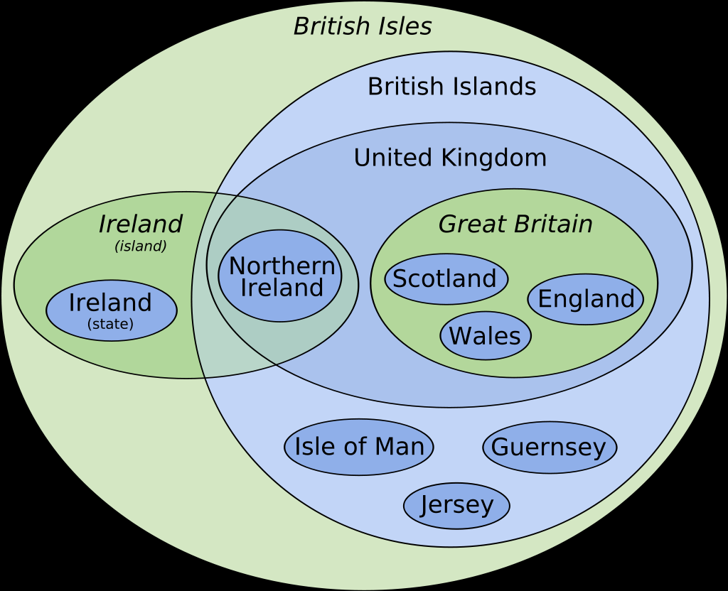
Can someone do one for terminology? Is calling people British mainly socially acceptable? I imagine the exception is the Irish from Ireland, but those from northern Ireland may give that a pass?
Data Is Beautiful
A place to share and discuss data visualizations. #dataviz
Call someone from Scotland British and see how that works out for you….
Going by the last polls it's about an equal chance whether they'd approve or not
Why the hell is it so complicated
I though it was complicated here in Australia where our states/territories (idk the differencd) all can have some very different rules and stuff at least we have mostly clear borders
Why the hell is it so complicated
One hell of a complex and crazy history in a very tiny space over the last two thousand years.
Hell, you could just cleave off the last thousand as a reference and be done with that. Although that does leave out some juicy origin stories.
Cool!
I wonder... how do/does Shetland islands?/ Archipelago? fit into this?
No one outside of the UK includes Ireland in the British Isles.
"British and Irish Isles" is the most common descriptor for the whole archipelago I see, and it seems a fair one even if it's a bit long. It'd be nice if we could all agree on something catchier but that seems unlikely, all things considered
I would... (Australian)
Speaking of! Shouldn't Australia be in that chart too? And I'd like to see the "commonwealth" in the diagram too. It's all good complicated!
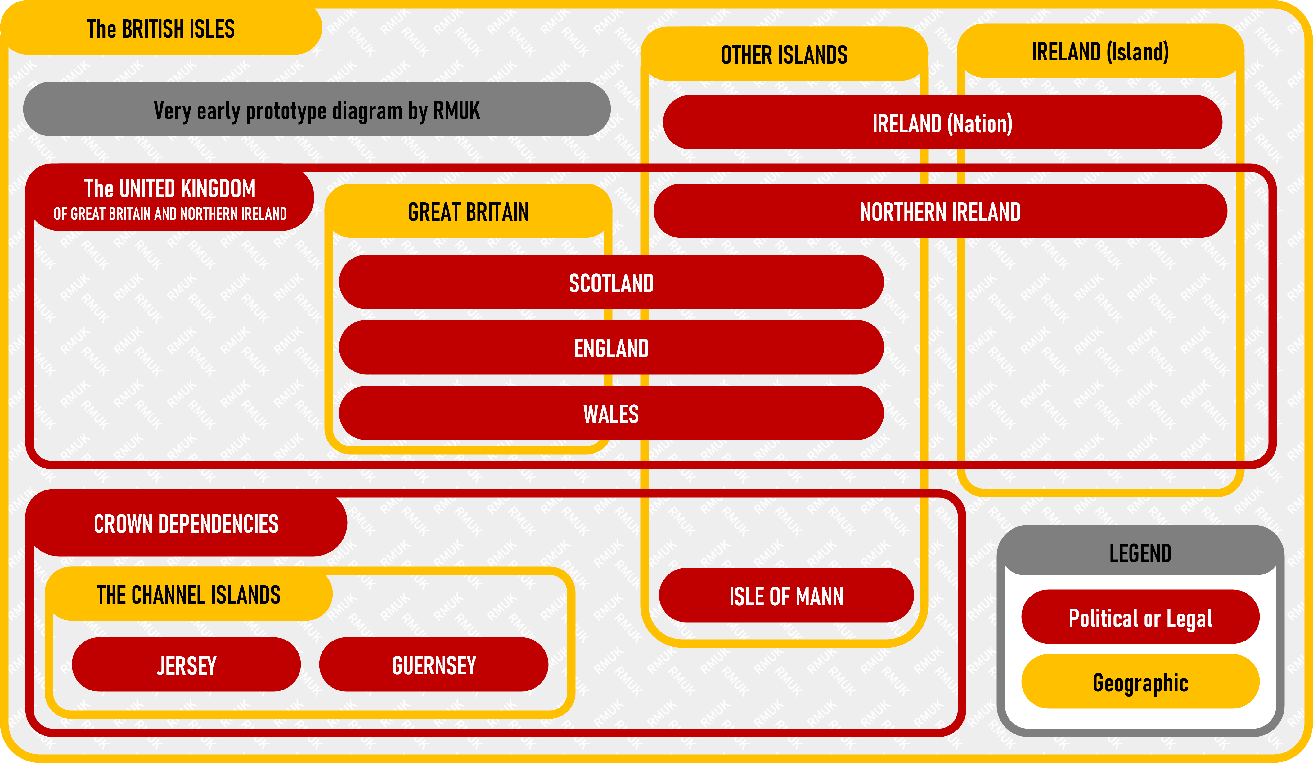
So I'm late to the party here, but this is a very early version of a diagram I'm putting together that corrects a couple of issues with the diagram OP posted.

As I said: very early and also very incomplete, but what's there is accurate.
I’m into it! I can’t wait to see where this goes.
