325
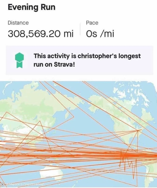
Christopher went for a long run this evening.
(programming.dev)
A community for posting software malfunctions
Deliberately bad software or bad design is not software gore, it must be something unintentional
Icon base by Delapouite under CC BY 3.0 with modifications to add a gradient and shear it

This is more about the weird pathing and not the distance, but here's what it looks like when I have a bouldering session. Apparently I spend a lot of time outside and pass through walls.
Get it with a Garmin that uses the two satellite types and worse with a Suntu I use for extreme outdoors. Must be a tin roof or something.
Just standard GPS drift tbh
22m elevation during a boulder session? Pick up the slack jeez.