you are viewing a single comment's thread
view the rest of the comments
[–] 4 points 2 years ago* (last edited 2 years ago) (7 children)

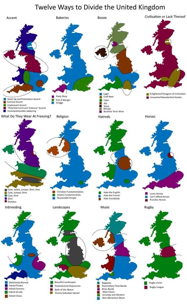
I was very confused by the shape of this United Kingdom. For reference, this is what it + the non-UK part of Ireland actually looks like:

I'm guessing, they left out all the islands, but even then, it still doesn't look terribly accurate to me, so no idea...

Edit: Added clarification about Southern Ireland.

  • source
  • hideshow 7 child comments
  • [–] 14 points 2 years ago (3 children)

    Careful what you call United Kingdom! They left out Ireland because it's not part of UK

  • source
  • parent
  • hideshow 3 child comments
  • [–] 2 points 2 years ago (2 children)

    Ah yeah, good point. I was very confused by Southern Ireland missing on their map, too, but my comment made it sound like that's part of the UK.

  • source
  • parent
  • hideshow 2 child comments
  • [–] [S] 2 points 2 years ago (1 child)

    You also want to be careful using terms like 'Southern Ireland'. Northern Ireland is a thing, and the Republic of Ireland is a thing...

  • source
  • parent
  • hideshow 1 child comment
  • [–] 5 points 2 years ago

    They rotated it slightly to get the south coast more horizontal and binned off most islands (the Shetlands and Orkneys I can understand but the Isle of Man wasn't in the way).so they could pack more into the space.

  • source
  • parent